Beyond aerial photography: Exploring innovative new applications of drone footage
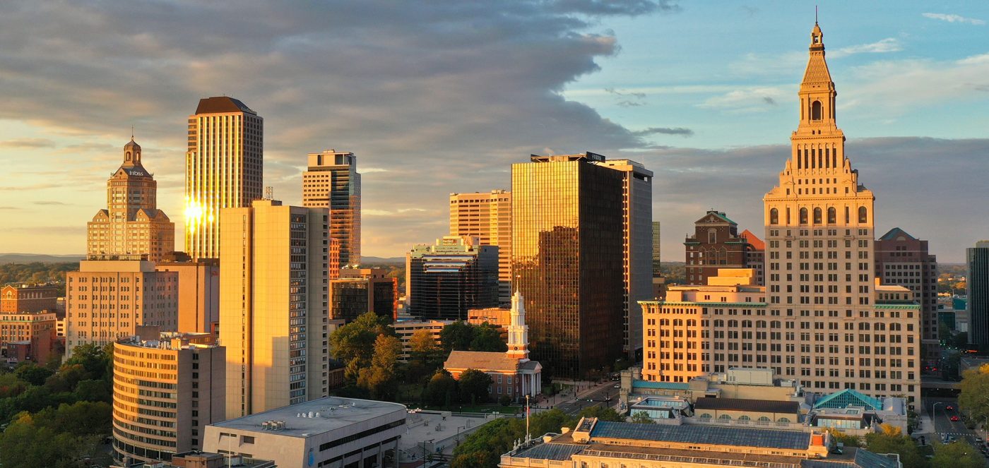
Drone cameras may have once been the province of science fiction, but today they serve a variety of purposes in the real world. Aerial photography of high-end and commercial real estate is now so commonplace the average person doesn’t even think twice when they see drone images of beautiful estates while browsing Zillow.
It’s no surprise that drone photos have become familiar so quickly. Aerial imaging can generate interest and excitement within your audience leading to more conversions like vacation bookings or high-end homes sold. With these benefits in mind, we have seen a drone boom. As of May 2022, there were a reported 855,860 drones registered in the United States by the FAA — 37% of those registrations were for commercial operation. This boom is for good reason, as drone footage can transform traditional and digital marketing no matter what industry a company operates in.
Whether the goal is to attract new members to a country club, draw visitors to a resort, or bring investors to a commercial property, drone photography and video transports the viewer to the location in question, providing both an up-close, highly-detailed experience and broad views highlighting the scope and scale. But that’s not all it can do.
The evolution of drone photography
We have come a long way since the first cameraless drones came on the scene. Today’s drones are capable of taking low and high-resolution photos, 360º views, panoramas, and even delivering high-resolution 4K and Now 8K video clips or fully edited 1-2 minute shorts.
As technology advances, we are finding a variety of use cases for drones beyond taking groundbreaking aerial photographs. Not only have Capture Visual Marketing’s images been used to aid in planning COVID-safe events, but with 3D imagery, we can now use drones to assist architects in planning and restoration projects, turn images into CAD conversions, and more.
Photogrammetry, the science of measuring real-life distances from photos, has also benefitted from more sophisticated drone technology. By combining enough overlapping images of the same features, coupled with spatial data (including GPS), photogrammetry software can be used to generate photorealistic 3D representations of topographic surfaces. Capture Visual Marketing has used photogrammetry to create accurate, high-resolution digital models with 3D models, real-time 2D maps, and 360º virtual tours.
More use cases for aerial photography
With every new improvement, the number of ways we are able to use aerial photography grows. Here are a few of the most common — and innovative — ways Capture Visual Marketing uses drones:
- Construction — We find drones useful at every stage of construction. From creating interactive site views (including maps, photos, panoramas, and videos) in the planning phases to sharing updates with stakeholders, drone can keep construction projects running smoothly.
- Property inspections — Improve annual budget processes with automated condition assessments by monitoring roof, pavement, and exterior conditions.
- Insurance — Drone allows property owners and insurance companies to quickly and accurately assess risk and claims with aerial and thermal documentation.
- Property and facility management — A visual record of site conditions allows for a deeper understanding of repair and maintenance needs across a portfolio of properties, resulting in better workflow prioritization.
- Agriculture — Map fields in minutes, instead of days or weeks, to conduct counts, identify variability, determine elevation maps, and survey plant health with the help of drones.
- Historic preservation and mitigation — Drones allow us to survey historic buildings and structures, diagnose building failures, and aid in restoration projects by scanning and converting to 3D models to be used in CAD.
- Energy and utilities — Utility companies have hundreds of miles of power lines and other infrastructure to monitor. Drones make it possible to cover more ground and do closer, more accurate inspections to discover anomalies invisible to the naked eye, all while team members stay safely on the ground.
Things to think about before hiring a drone photographer
Drone photography has a wide array of uses — more than we can realistically cover here — but there are also a variety of factors to take into consideration before hiring a photographer. For instance, having a drone pilot who is licensed to operate by the FAA is integral to complying with regulations.
Capture Visual Marketing recently worked on a construction project with Goman+York for Goodwin University in East Hartford, Connecticut. Our drones monitored the construction progress for a year, but because the building is directly across the street from Pratt & Whitney — an airplane manufacturer with an airfield on-site — our pilots had to get clearance every time they flew, and steer clear of Pratt’s property. These kinds of concerns are why it’s imperative to find licensed drone photographers with the right experience for each project.

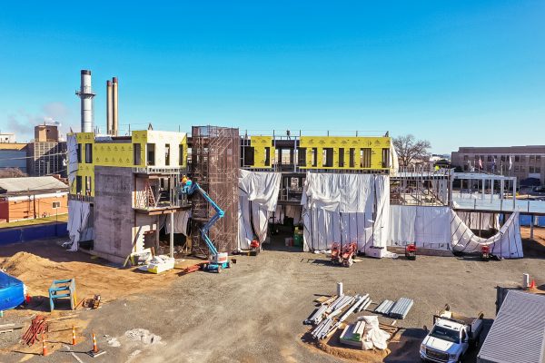
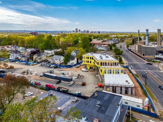
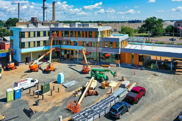
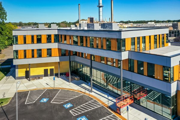
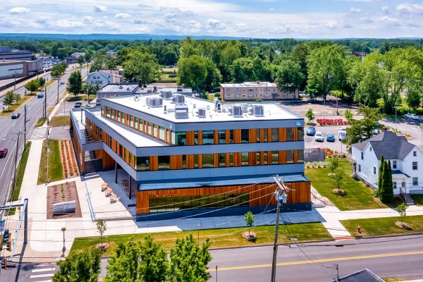
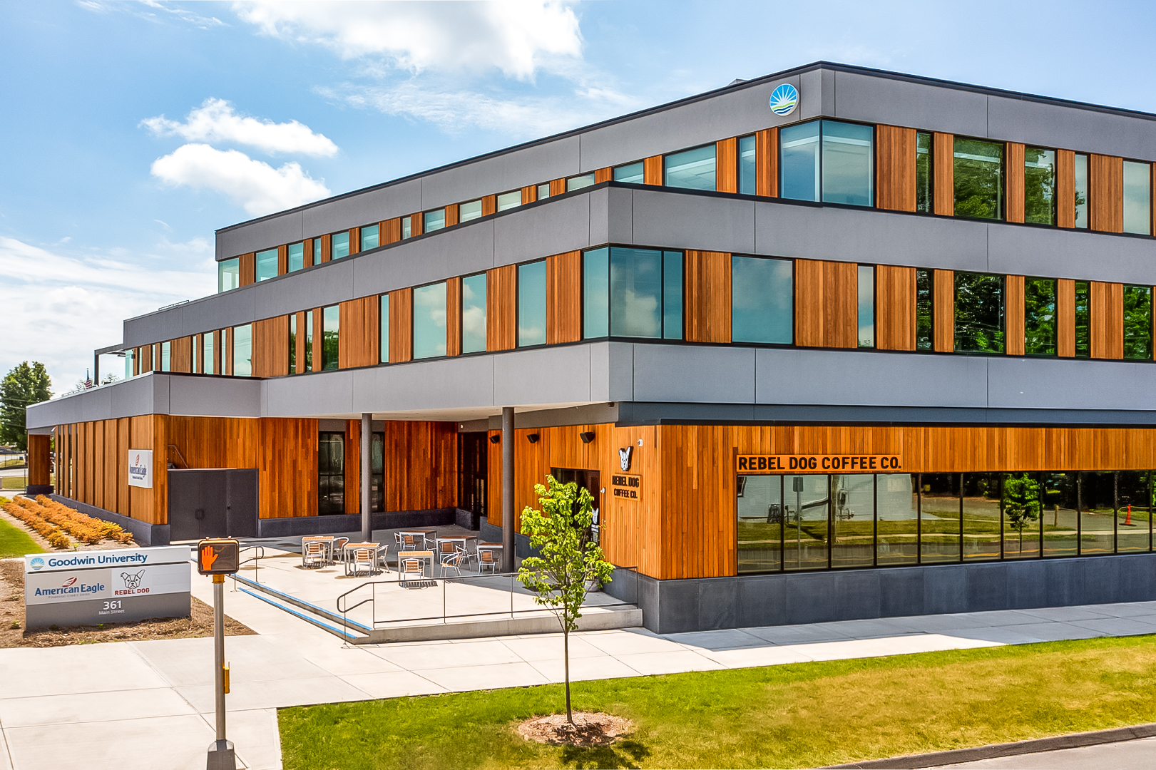
Goodwin University
361 Main Street, East Hartford, CT
Drone Imaging Services by Capture Visual Marketing. Credit: Drone Photography & Video by Paul Coco. Direction & Editing by Tony Healy